
The RiVA Mapping Tool & Data Dashboard provide mapped and localised data to aid Community Service Organisations, communities and Government agencies to:
- emphasise the intersection between disaster risk and socio-economic vulnerability
- plan activities and inform resource allocation based on identification of communities/locations with higher levels of social disadvantage and vulnerability
- identify Community Service Organisations providing services in particular locations to facilitate disaster-related collaboration, communication and coordination
- understand local service delivery capacity and constraints, and
- advocate for resources and disaster support
Developed as a prototype, the RiVA Mapping Tool & Data Dashboard currently contain data for the following Local Government Areas:
-
- Hawkesbury City
- Bega Valley
- Snowy Monaro
- Eurobodalla
- Kyogle
- Lismore
- Richmond Valley
Acknowledgements
The RiVA Mapping Tool & Data Dashboard has been developed with significant contributions from:
- Yogi Vidyattama and Xuan-Binh (Benjamin) Vu, Faculty of Business, Government and Law, University of Canberra for the development of the RiVA Mapping Tool using ArcGIS and compilation of data in the RiVA Data Dashboard.
- Resilient Lismore Disaster Ready Together staff and Southern Cross University students for the disaster-related vulnerability data methodology used in the RiVA Data Dashboard.
- Infoxchange for the Community Service Organisation data used in the RiVA Mapping Tool and Data Dashboard.
- NCOSS Mapping Economic Disadvantage in NSW Data Dashboard and Online Mapping Tool for concept and source data.
- The Project was funded by the Australian Government and NSW Government.
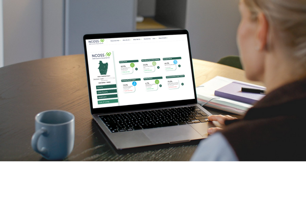
RiVA Mapping Tool & Data Dashboard
-
RiVA Mapping Tool
RiVA Mapping Tool (ArcGIS Map) How to use the RiVA Mapping Tool -
RiVA Data Dashboard
RiVA Data Dashboard (Excel spreadsheet) How to use the RiVA Data Dashboard
Disaster-related vulnerabilities data
If you would like to understand disaster-related vulnerabilities to small geographic areas (SA2 level) within your LGA, data is available for Hawkesbury City, Bega Valley, Snowy Monaro, Eurobodalla, Kyogle, Lismore and Richmond Valley.
- Visit the Resilient Lismore Disaster Ready Together webpage for Disaster-related vulnerabilities in Kyogle, Lismore & Richmond Valley LGAs.
- To access data for Hawkesbury City, Bega Valley, Snowy Monaro and Eurobodalla LGAs, contact the NCOSS team, info@ncoss.org.au.
Completing the picture
The RiVA Mapping Tool & Data Dashboard provide the base data to support planning aligned to social and economic needs in the face of increasing disasters.
While data is a key consideration, local information and perspectives are also essential to gaining a complete picture of disaster risk and community needs.
When investigating local risks, vulnerabilities and assets, also include:
- First Nations practices for caring for Country and community
- Local experiences and knowledge of past disaster events
- Information from local Emergency Service personnel
- Skillsets and reach of Community Service Organisations and community groups – trust, reputation and any service gaps
- Established community service interagencies and networks
- Government agencies and larger Community Service Organisations active in the area
- Barriers to and enablers of engagement and change
- Other community assets and coping capacities
Methodology & Data Sources
RiVA Mapping Tool & Data Dashboard Methodology and Data Sources
Contact us
Contact the NCOSS team if you would like to know more about mapping to reduce disaster risk, info@ncoss.org.au